Hagerstown, Maryland
| Hagerstown | |||
|---|---|---|---|
| — City — | |||
| Corporation of Hagerstown, Maryland | |||
 |
|||
|
|||
| Nickname(s): Hub City, Maryland's Gateway to the West,[1] H-Town, (formerly) Home of the Flying Boxcar | |||
| Motto: A Great Place to Live Work and Visit | |||
 |
|||
| Coordinates: | |||
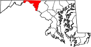
| Country | |||
| State | |||
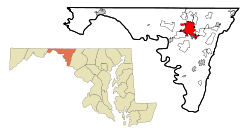
| County | Washington | ||
| Founded | 1762 | ||
| Incorporated | 1813 | ||
| Government | |||
| - Mayor | Robert E. Bruchey II (R) | ||
| - City Council |
Council members
|
||
| - Senate | Donald F. Munson (R) | ||
| - Delegate | John P. Donoghue (D) | ||
| - U.S. Congress | Roscoe Bartlett (R) | ||
| Area | |||
| - City | 27.6 km2 (10.7 sq mi) | ||
| - Land | 27.5 km2 (10.7 sq mi) | ||
| - Water | 0.04 km2 (0.01 sq mi) | ||
| - Urban | 196.4 km2 (76.7 sq mi) | ||
| - Metro | 2,637 km2 (1,019 sq mi) | ||
| Elevation | 164 m (538 ft) | ||
| Population (2008) | |||
| - City | 39,728 | ||
| - Density | 1,444.7/km2 (3,712.9/sq mi) | ||
| - Urban | 120,326 | ||
| - Urban density | 612.7/km2 (1,568.8/sq mi) | ||
| - Metro | 263,753 | ||
| - Metro density | 100.0/km2 (258.8/sq mi) | ||
| - Demonym | Hagerstonian | ||
| [Urban figures taken from 2000 U.S. Census.] | |||
| Time zone | Eastern (EST) (UTC-5) | ||
| - Summer (DST) | EDT (UTC-4) | ||
| ZIP code(s) | 21740-21749 | ||
| Area code(s) | 301, 240 | ||
| FIPS code | 24-36075 | ||
| GNIS feature ID | 0598385 | ||
| Website | www.hagerstownmd.org | ||
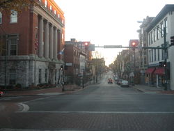
Hagerstown (pronounced /ˈheɪɡərztaʊn/[2]) is a city in northwestern Maryland, United States. It is the county seat of Washington County,[3] and, by many definitions, the largest city in a region known as Western Maryland.[1] The population of Hagerstown city proper, according to estimates conducted by the United States Census Bureau for a 12-month period ending 1 July 2008, is 39,728,[4] and the total 2000 Urbanized Area population is 120,326 [5](~80,000 in MD). Hagerstown ranks as Maryland's sixth largest city,[6] but if the urban area were to likewise incorporate, it would be Maryland's second-most populous city.
Hagerstown anchors the Hagerstown-Martinsburg, MD-WV Metropolitan Statistical Area, which lies just northwest of the Washington-Baltimore-Northern Virginia, DC-MD-VA-WV Combined Statistical Area in the heart of the Great Appalachian Valley. The population of the metropolitan area in 2000 was 222,771 and the 2008 estimate is 263,753 (U.S. Rank 169). Greater Hagerstown is the fastest growing metropolitan area in the state of Maryland and among the fastest growing in the United States.[7]
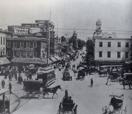
Despite its semi-rural Western Maryland setting, Hagerstown is a center of transit and commerce. Interstates 81 and 70, CSX, Norfolk Southern, and the Winchester and Western railroads, and Hagerstown Regional Airport form an extensive transportation network for the city. Hagerstown is also the chief commercial and industrial hub for a greater Tri-State Area that includes much of Western Maryland as well as significant portions of South Central Pennsylvania and the Eastern Panhandle of West Virginia. Hagerstown has often been referred to as, and is nicknamed, the Hub City.[1]
Contents |
History
Founding
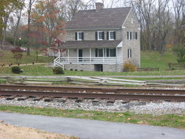
In 1739, Jonathan Hager, a German immigrant from Pennsylvania and a volunteer Captain of Scouts, purchased 200 acres of land in the Great Appalachian Valley between the Blue Ridge and Allegheny Mountains in Maryland and called it Hager’s Fancy. In 1762, Hager officially founded the town of Elizabethtown which he named after his wife, Elizabeth Kershner. Fourteen years later, Jonathan Hager became known as the "Father of Washington County" after his efforts helped Hagerstown become the county seat of newly created Washington County which Hager also helped create from neighboring Frederick County, Maryland. The City Council changed the community's name to Hagerstown in 1813 because the name had gained popular usage, and in the following year, the Maryland State Legislature officially endorsed the changing of the town’s name.[1]
Civil War
Hagerstown's strategic location at the border between the North and the South made the city a primary staging area and supply center for four major campaigns during the Civil War.
In 1861, General Robert Patterson's troops used Hagerstown as a base to attack Virginia troops in the Shenandoah Valley.
In the Maryland Campaign of 1862, General James Longstreet's command occupied the town while en route to the Battle of South Mountain and Antietam.
In 1863, the city was the site of several military incursions and engagements as Gen. Robert E. Lee's army invaded and retreated in the Gettysburg Campaign.
In 1864, Hagerstown was invaded by the Confederate Army under Lt. Gen. Jubal Early. On Wednesday, July 6, Early sent 1,500 cavalry, commanded by Brig. Gen. John McCausland, into Hagerstown to levy a ransom for $200,000 and a large amount of clothing, in retribution for Federal destruction of farms, feed and cattle in the Shenandoah Valley. McCausland misread the amount, instead collecting $20,000. This is in contrast to neighboring Chambersburg, Pennsylvania, which McCausland razed on July 30 when the borough failed to supply the requested ransom of $500,000 in U.S. currency, or $100,000 in gold.
Throughout the Civil War, private physicians and citizens of Hagerstown succoured men from both the North and South in a number of locations, including the Franklin Hotel, Washington House, Lyceum, Hagerstown Male Academy, Key-Mar College, and a number of private residences.
The spread of smallpox by returning soldiers to families and friends was a substantial problem during the war. The Bethel Methodist Episcopal Church volunteered the use of its church as a smallpox hospital when an epidemic spread throughout the town.
Following the war in 1872, Maryland and Virginia cooperated to re-inter Southern Confederate dead from their impromptu graves to cemeteries in Hagerstown, Frederick and Shepherdstown, West Virginia. Roughly 60% however, remained unidentified. In 1877, 15 years after the Battle of Antietam, also known as the Battle of Sharpsburg, approximately 2,800 Confederate dead from that battle were re-interred in Washington Confederate Cemetery and in Rosehill Cemetery in Hagerstown.[8]
Railroads
Hagerstown's nickname of the "Hub City" came from the large number of railroads (and roads) that served the city. Hagerstown was the center of the Western Maryland Railway and an important city on the Pennsylvania, Norfolk and Western, Baltimore and Ohio, and Hagerstown and Frederick Railroads. Currently, the city is a vital location on CSX, Norfolk Southern, and the Winchester and Western Railroads.
Hagerstown was formerly served by the Hagerstown & Frederick Railway, an interurban trolley system, from 1896 to 1947.
Little Heiskell

One of the most recognizable symbols of Hagerstown is the weathervane known as "Little Heiskell." Named after the German tinsmith Benjamin Heiskell who crafted it in 1769 in the form of a Hessian soldier,[1] it stood atop the Market House first and City Hall second for a combined 166 years. It was moved from the Market House to City Hall in 1824.
During the American Civil War era, the weathervane gained its characteristic bullet hole from a Confederate sharpshooter, who won a bet after shooting it from a full city block away.
Finally in 1935, the original was retired to the Museum of the Washington County Historical Society, later to be moved to its present display in the Jonathan Hager House. An exact replica has replaced it atop City Hall.
The weathervane has also been depicted in the city's annual Mummers Day Parade by Mr. Charles Harry Rittenhouse, Sr. sporting all of the necessary accoutrements of a German Mercenary Soldier.
Little Heiskell is now also the mascot of North Hagerstown High School.
Aviation heritage
From 1931 to 1984, Fairchild Aircraft was based in Hagerstown, Maryland and was by far the area's most prominent employer. The importance of the company to the city and the country as a whole earned Hagerstown its former nickname "Home of the Flying Boxcar."
Fairchild moved to Hagerstown from Farmingdale, New York in 1931 after Sherman Fairchild purchased a majority stock interest in Kreider-Reisner Aircraft Company of Hagerstown in 1929. Among Fairchild's products during World War II were PT-19/PT-23/PT-26 (Cornell) and AT-21 trainers, C-82 "Packet" cargo planes and missiles. At its height in World War II, Fairchild employed directly and indirectly up to 80% of Hagerstown's workforce or roughly 10,000 people.
In the postwar era, Fairchild continued to produce aircraft in Hagerstown such as C-123 Provider, Fairchild F-27 and Fairchild Hiller FH-227, FH-1100, C-26 Metroliner, UC-26 Metroliner, Fairchild Republic A-10 Thunderbolt II, and the T-46 jet trainer.
All production ceased in Hagerstown in 1984 and the company moved elsewhere. Presently, the company is based in San Antonio, Texas and after a series of mergers and acquisitions, is known as M7 Aerospace.
The Hagerstown Aviation Museum shows many of these original aircraft. Among the ones on display are: 1939 F24/UC-61C, 1945 C-82A, 1943 PT-19A, and the 1953 C-119.[9] The museum is located near Hagerstown Regional Airport in the airport's former terminal.
Hagerstown is also the birthplace of Salisbury, Maryland-based Piedmont Airlines which started out as Henson Aviation. It was founded by Richard A. Henson in 1931. Today, Hagerstown Regional Airport-Richard A. Henson Field is named as such in honor of the airlines' founder.
Today, only small to medium-sized aviation companies remain in the area. Three notable names include Northrop Grumman California Microwaves, which manufactures airline equipment in its Hagerstown facility, Fugro EarthData, which maintains its aviation division in Hagerstown, and Sierra Nevada Corporation, a defense electronics engineering and manufacturing contractor.
Geography
Location and topography
Hagerstown is located at (39.642771, -77.719954).[10] It is south of the Mason-Dixon Line and north of the Potomac River and between the Blue Ridge and Allegheny Mountains in a part of the Great Appalachian Valley known regionally as Cumberland Valley and locally as Hagerstown Valley. The community also lies within close proximity of Pennsylvania, West Virginia, and Virginia. Hagerstown, by driving distance, is approximately 70 miles (110 km) northwest of Washington, D.C., 72 miles (116 km) west-northwest of Baltimore, Maryland, and 74 miles (119 km) southwest of Harrisburg, Pennsylvania.
According to the United States Census Bureau, the city has a total area of 10.7 square miles (27.6 km²), of which 10.7 square miles (27.6 km²) of it is land and 0.09% is water. Major waterways within Hagerstown include Hamilton Run and Antietam Creek that are tributaries of the Potomac River. Natural landscape around Hagerstown consists of low, rolling hills with elevations of 500 feet (150 m) to 800 feet (240 m) above sea level and rich, fertile land that is well-suited and utilized for dairy farming, cornfields, and fruit orchards typical of Mid-Atlantic agriculture.
Climate
Hagerstown is situated in the transition between the humid subtropical climate zone and the humid continental climate zone (Köppen Dfa), with hot, humid summers and moderately cold winters.
| Climate data for Hagerstown, Maryland | |||||||||||||
|---|---|---|---|---|---|---|---|---|---|---|---|---|---|
| Month | Jan | Feb | Mar | Apr | May | Jun | Jul | Aug | Sep | Oct | Nov | Dec | Year |
| Average high °F (°C) | 41 (5) |
44 (6.7) |
51 (10.6) |
65 (18.3) |
75 (23.9) |
83 (28.3) |
88 (31.1) |
85 (29.4) |
78 (25.6) |
68 (20) |
53 (11.7) |
42 (5.6) |
64 (17.8) |
| Average low °F (°C) | 25 (-3.9) |
27 (-2.8) |
31 (-0.6) |
43 (6.1) |
51 (10.6) |
59 (15) |
63 (17.2) |
61 (16.1) |
54 (12.2) |
45 (7.2) |
34 (1.1) |
26 (-3.3) |
43 (6.1) |
| Rainfall inches (mm) | 2.7 (69) |
2.6 (66) |
3.5 (89) |
3 (76) |
3.7 (94) |
3.5 (89) |
3.5 (89) |
3.8 (97) |
2.8 (71) |
2.5 (64) |
2.9 (74) |
2.8 (71) |
37.2 (945) |
| Snowfall inches (cm) | 4.9 (12.4) |
3.7 (9.4) |
6 (15) |
0.4 (1) |
0 (0) |
0 (0) |
0 (0) |
0 (0) |
0 (0) |
0 (0) |
1.2 (3) |
4.8 (12.2) |
21 (53) |
| Source: Weatherbase | |||||||||||||
Demographics
As of the U.S. census[11] of 2000, there were 36,687 people, 15,849 households, and 9,081 families residing in the city. Updated 1 July 2008 census estimates reflect Hagerstown having 39,728 people, an increase of 8.3% from the year 2000.
According to Census 2000 figures, the population density was 3,441.5 people per square mile (1,328.8/km²). There were 17,089 housing units at an average density of 1,603.1/sq mi (619.0/km²). The racial makeup of the city was 85.95% White, 10.15% African American, 1.77% Hispanic or Latino, 0.25% Native American, 0.96% Asian, 0.04% Pacific Islander, 0.83% from other races, and 1.83% from two or more races. There were 17,154 males and 19,533 females residing in the city.[12]
There were 15,849 households out of which 29.5% had children under the age of 18 living with them, 36.8% were married couples living together, 15.9% had a female householder with no husband present, and 42.7% were non-families. 35.4% of all households were made up of individuals and 12.9% had someone living alone who was 65 years of age or older. The average household size was 2.26 and the average family size was 2.93.
In the city the population was spread out with 25.6% under the age of 18, 9.0% from 18 to 24, 31.0% from 25 to 44, 20.1% from 45 to 64, and 14.3% who were 65 years of age or older. The median age was 35 years. For every 100 females there were 87.8 males. For every 100 females age 18 and over, there were 83.6 males.[13]
The median income for a household in the city was $30,796, and the median income for a family was $38,149. Males had a median income of $31,200 versus $22,549 for females. The per capita income for the city was $17,153. About 15.1% of families and 18.1% of the population were below the poverty line, including 27.0% of those under age 18 and 13.7% of those age 65 or over.[14]
Government
Mayor
The current city executive or Mayor of Hagerstown is Robert "Bob" E. Bruchey II (R) who has served the city since March 2006.
Past Mayors:
|
|
|
City Council
The representative body of Hagerstown is known as the City Council. Among its members are: Lewis Metzner, William M. Breichner, Martin Brubaker, Forrest Easton, and Ashley Haywood.
Other representation
Donald F. Munson represents Hagerstown in the Maryland Senate while John P. Donoghue stands for the Hagerstown area in the Maryland House of Delegates. Roscoe Bartlett serves Maryland's 6th congressional district which includes Hagerstown in the U.S. Congress.
Economy
Once primarily an industrial community, Hagerstown's economy depended heavily on railroad transportation and manufacturing, notably of aircraft, trucks, automobiles, textiles, and furniture.[1] Today, the city has a diversified, stable business environment with modern service companies in various fields as well as continued strength in manufacturing and transportation in railroads and highways. Surrounding Hagerstown, there has been and continues to be a strong agricultural presence while tourism, especially with respect to the retail sector, also provides support to the local economy.
Major companies
(*=corporate headquarters in area)
|
|
Healthcare
- Brook Lane Psychiatric Center, private mental health facility.
- Washington County Hospital, community hospital.
- Western Maryland Hospital Center, chronic-care state-run health center.
Shopping
Hagerstown-Washington County boasts one of the highest densities of retail in the country.[16]
Hagerstown has 2 major shopping malls:
- Prime Outlets Hagerstown, a 100+ store outlet mall which attracts visitors from Washington and Baltimore as well as nearby counties.
- Valley Mall, anchored by Macy's, JCPenney, Sears, The Bon-Ton, Old Navy, Toys R Us, and Regal Cinemas 16.
Other significant retail centers/areas include:
- Dual Hwy.- Wonder Book & Video and Super Shoes.
- Garland Groh Blvd.- Wal-Mart Supercenter, Home Depot, Dick's Sporting Goods, PetSmart, Pier 1 Imports, Bed Bath and Beyond, Office Max, Marshalls, A.C. Moore, Border's Books and Music, Five Below, and Best Buy.
- Longmeadow/Leitersburg Pike- Ashley Furniture, Pennsylvania Dutch Market, Lowe's, and Hagerstown Cinemas 10.
- South End/Town Center- Aaron's, Jo-Ann Fabrics, Big Lots, and Tuesday Morning.
- Wesel Blvd./Halfway Blvd./Massey Blvd./Cole Rd.- Kmart, Ollie's Bargain Outlet, Tractor Supply, Staples, Value City Furniture, Sam's Club, Just Cabinets &, Lowe's, Petco, David's Bridal, Michael's Craft, Target, Kohl's, RoomStore Furniture, Christmas Tree Shops, and Ross Dress For Less.
Infrastructure
Highways
|
|
Mass transportation
- The County Commuter buses provide extensive transportation within the city. More limited service is available to surrounding communities in Washington County.
- The Maryland Transit Administration operates the Route 991 commuter bus on weekdays to nearby Frederick, Maryland and the Shady Grove Metro Station, where riders can transfer to reach Washington, D.C..
- Miller Cabs and Turner Vans service the Hagerstown area but are usually available only upon request. Downtown Taxi! offers cab service people can hail in the downtown vicinity.
- Greyhound Lines and Atlantic Charter Buses provide coach bus service to major cities near and far including directly to Baltimore, Harrisburg, Richmond, and Washington.
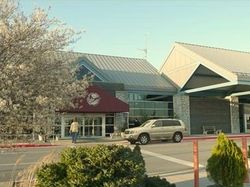
- Hagerstown Regional Airport (IATA: HGR, ICAO: KHGR, FAA LID: HGR), also known as Richard A. Henson Field, is located approximately 5 miles (8.0 km) due north of Hagerstown off U.S. Route 11 and Interstate 81. It is a frequent landing site for the U.S. President on the way to Camp David. The airport is commercially serviced by Allegiant Air with flights to and from Orlando Sanford International Airport and CapeAir with flights to and from Baltimore-Washington International Thurgood Marshall Airport.[17][18] Alternatively, Washington Dulles International Airport, Washington National Airport, Baltimore-Washington Airport, and Harrisburg International Airport offer more extensive flight destinations and are all within 60 miles (97 km) to 75 miles (121 km) of Hagerstown.
- Despite being at the crossroads of CSX, Norfolk Southern, and the Winchester and Western railroads, there is no passenger rail service in Hagerstown. Martinsburg, WV offers Amtrak and MARC Train service to Union Station in Washington, D.C. while Frederick offers MARC commuter rail service as well.
Utilities
- Electricity within the city is distributed at cost by Hagerstown Light Department, a municipal electric utility.[19] Outside the city limits, electricity is provided by Potomac Edison, a regional subsidiary of Allegheny Power, which itself is a division of Allegheny Energy.
- Columbia Gas of Maryland, Inc., a subsidiary of NiSource, services the area with natural gas.[20]
- The city's water supply is provided by City of Hagerstown Water & Sewer Department with public drainage at Antietam Drainage Basin.[21]
- Hagerstown-based Antietam Cable, a subsidiary of Schurz Communications, provides the area's cable television.
- Landline phone service in Hagerstown is provided by Verizon.
Culture
Historical sites
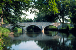
Hagerstown's location at the center of the Western Maryland region makes it an ideal starting point for touring, especially with respect to the Civil War. Antietam National Battlefield, the site of the bloodiest single day in American history, is located in nearby Sharpsburg, Maryland. South Mountain State Battlefield is also located in Washington County in Boonsboro. Gettysburg, Monocacy, and Harpers Ferry battlefields are all located within a 30 minute drive of Hagerstown.
Fort Frederick State Park, which features a restored fort used in the French and Indian War, is west of the city in nearby Big Pool, Maryland.
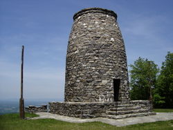
Washington Monument State Park near Boonsboro pays tribute to the country's first president, George Washington. It is the oldest structure to honor the 'father of our country.'
Hagerstown is also home to the Chesapeake and Ohio Canal National Historical Park Headquarters.
The city also has a number of sites and districts listed on the National Register of Historic Places.[22]
Parks and museums

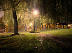
Within the city, there are numerous parks including Hagerstown City Park, which is home to the Washington County Museum of Fine Arts, Mansion House Art Gallery, Western Maryland 202 Locomotive Display and Museum, and the Hager House and Museum (once home of Jonathan Hager, founder of Hagerstown).[1] Outside of the Park, Hagerstown Roundhouse Museum showcases exhibits of Hagerstown's early railroad history. Discovery Station, located downtown, is a hands-on science and technology museum featuring exhibits in numerous galleries and display areas, including the Hagerstown Aviation Museum.
Theater and arts
Hagerstown is home to the Maryland Theatre,[1] a symphony house that plays host to the Maryland Symphony Orchestra and the annual Miss Maryland USA Beauty Pageants. The city also has the Washington County Playhouse, a traditional dinner theater. The new Academy Theatre Banquet & Conference Center, located downtown, houses the community theater group Potomac Playmakers.[23] And the Barbara Ingram School for the Arts will be opening as a magnet school for gifted art students in downtown Hagerstown's arts and entertainment district.
Festivals and events
Downtown Hagerstown recently has enjoyed a resurgence[1] and now hosts several popular annual events. Downtown Live! is an alternative festival that features live reggae and rock music and entertainment held at various times throughout the year.[24] The city draws thousands every year around May-June to the Western Maryland Blues Fest, which showcases blues artists from around the country. The popular Augustoberfest celebrates Hagerstown's German heritage.[25] And the annual Alsatia Mummers' Halloween Parade happens to be the largest nighttime parade on the East Coast.
Fairgrounds Park features recreational facilities such as the Hagerstown Ice & Sports Complex and hosts various events throughout the year like the annual Hagerstown Hispanic Festival held in mid-September.[26][27]
Professional sports
Hagerstown is home to the Hagerstown Suns minor-league baseball team. The Suns play in the South Atlantic League and are a Class A affiliate of the Washington Nationals. They play in Municipal Stadium.
To the west of the city lies Hagerstown Speedway, a nationally known dirt-track racing venue. Another professional racing track, Mason-Dixon Dragway, is located just southeast of Hagerstown.
Media
- The Herald-Mail, daily (Hagerstown-Tri State Area's newspaper of record).
- Hagerstown Magazine, monthly lifestyle magazine for Washington County and surrounding communities.
- The Crossroads, seasonal e-newsletter by Hagerstown-Washington County Convention and Visitor's Bureau.
- Smart Company, magazine for businesses in Washington and Frederick counties.
- Valley Revue, seasonal calendar magazine covering events in the Cumberland Valley, Shenandoah Valley, and beyond.
- J. Gruber's Hagers-Town Town and Country Almanack, America's second-oldest continuously published periodical which has gained worldwide fame for its remarkable accuracy in weather predictions. It is distributed in many True Value and Orgill hardware stores throughout the country.
- Review and Herald Publishing Association, one of two North American publishing giants for the Seventh Day Adventist Church.
- The Franklin Shopper, weekly advertiser.
- Picket News, weekly community interest news for the Tri-State Area.
Radio
Hagerstown shares a radio market, the 166th largest in the United States, with Chambersburg, Pennsylvania and Waynesboro, Pennsylvania.[28] The following box contains all of the radio stations in the area:
|
||||||||||||||
Television
Hagerstown is the base for four television stations and shares a Designated Market Area, the ninth largest in the United States, with Washington, D.C.[29]
|
|
|
|
|
|||||||||||||||||||||||||||||
Education
High schools
|
Public high schools (Administered by Washington County Public Schools)
In addition, many Hagerstown students attend the following:
|
Private high schools
|
Colleges and universities
- Hagerstown Community College, 2-year public community college.
- Kaplan University, Hagerstown Campus, formerly known as Kaplan College and Hagerstown Business College.
- Mount Saint Mary's University, Hagerstown Campus, offers Masters of Business Administration (MBA) degrees.
- University System of Maryland at Hagerstown, a branch of the University of Maryland offering various associate's, bachelor's, and master's degree programs in connection with other state colleges and universities in Maryland.
- Vinayaka Missions America University, India-based university with campuses throughout the world recently establishing its first American campus in Hagerstown.
Notable residents and natives
- See People from Hagerstown.
Sister cities and municipal partnerships
 Wesel, North Rhine-Westphalia, Germany (since 10 March 1952)[25]
 Hagerstown, Indiana, U.S. (unofficial)
Metropolitan area
Hagerstown-Martinsburg, MD-WV MSA consists of three counties:
- Washington County, Maryland
- Berkeley County, West Virginia
- Morgan County, West Virginia
The Primary Cities are Hagerstown, MD and Martinsburg, WV. Other communities in the MSA include: Halfway, MD, Paramount-Long Meadow, MD, Fountainhead-Orchard Hills, MD, Robinwood, MD, Maugansville, MD, Boonsboro, MD, Smithsburg, MD, Williamsport, MD, Falling Waters, WV, Hedgesville, WV, Inwood, WV and Berkeley Springs, WV.
The metropolitan area's population in 2000 was 222,771. The 2008 estimate is 263,753, making Greater Hagerstown the 169th largest metropolitan area in the United States. The growth rate from 2000-2008 is +18.4%, the 48th highest among metropolitan areas in the entire country and the highest in Maryland (and in West Virginia).[7] The growth is mostly due to the influx of people from Washington, D.C. and Baltimore, MD.
References
- ↑ 1.0 1.1 1.2 1.3 1.4 1.5 1.6 1.7 1.8 Hagerstown, Maryland, mdoe.org Maryland Online Encyclopedia. Retrieved 15 September 2008.
- ↑ Hagerstown - Definitions from Dictionary.com
- ↑ "Find a County". National Association of Counties. http://www.naco.org/Template.cfm?Section=Find_a_County&Template=/cffiles/counties/usamap.cfm. Retrieved 2008-01-31.
- ↑ Table 4: Annual Estimates of the Resident Population for Incorporated Places in Maryland, Listed Alphabetically: April 1, 2000 to July 1, 2008, U.S. Census Bureau, 2008. Released 01 July 2009. Retrieved 01 July 2009.
- ↑ USA Urbanized Areas: 2000 Ranked by Population (465 Areas), Demographia, 2000. Retrieved 2007.
- ↑ Maryland by Place - GCT-T1-R. Population Estimates (geographies ranked by estimate), U.S. Census Bureau, 2006. Retrieved 2007.
- ↑ 7.0 7.1 Table 7. Cumulative Estimates of Population Change for Metropolitan Statistical Areas and Rankings: April 1, 2000 to July 1, 2008, Census Bureau 2009. Retrieved 26 April 2009.
- ↑ The Crossroads of the Civil War - Hagerstown, Hagerstown-Washington County Convention & Visitor's Bureau, Civil War, Retrieved 2007.
- ↑ Fairchild Aircraft, Retrieved 2007.
- ↑ "US Gazetteer files: 2000 and 1990". United States Census Bureau. 2005-05-03. http://www.census.gov/geo/www/gazetteer/gazette.html. Retrieved 2008-01-31.
- ↑ "American FactFinder". United States Census Bureau. http://factfinder.census.gov. Retrieved 2008-01-31.
- ↑ "DP-1. Profile of General Demographic Characteristics: 2000
Data Set: Census 2000 Summary File 1 (SF 1) 100-Percent Data
Geographic Area: Hagerstown city, Maryland". Census 2000 Gateway. http://www.census.gov/main/www/cen2000.html. Retrieved 2008-01-06. - ↑ "QT-P1. Age Groups and Sex: 2000
Data Set: Census 2000 Summary File 1 (SF 1) 100-Percent Data
Geographic Area: Hagerstown city, Maryland". Census 2000 Gateway. http://www.census.gov/main/www/cen2000.html. Retrieved 2008-01-06. - ↑ "DP-3. Profile of Selected Economic Characteristics: 2000
Data Set: Census 2000 Summary File 4 (SF 4) - Sample Data
Geographic Area: Hagerstown city, Maryland". Census 2000 Gateway. http://www.census.gov/main/www/cen2000.html. Retrieved 2008-01-06. - ↑ Maryland Manual | http://www.msa.md.gov/msa/mdmanual/37mun/hagerstown/html/hmayors.html
- ↑ Tom Riford, Hagerstown area called a Retail Mecca, The Herald-Mail ONLINE, Published Thursday January 6, 2005, Retrieved 2007.
- ↑ Sarah Hopkins, Allegiant Air Takeoff To Orlando A Success, Your4State.com, Published Friday 14 November 2008, Retrieved Saturday 15 November 2008.
- ↑ Jeannie Flitner, New Service to Baltimore Takes off From Hagerstown, Your4State.com, Published Tuesday 24 March 2009, Retrieved Tuesday 24 March 2009.
- ↑ Hagerstown Light Department
- ↑ Electric & Gas, Hagerstown EDC - Utilities, Hagerstown-Washington County Economic Development Commission. Copyright 2008. Retrieved 16 February 2009.
- ↑ Water & Sewer, Hagerstown EDC - Utilities, Hagerstown-Washington County Economic Development Commission. Copyright 2008. Retrieved 16 February 2009.
- ↑ "National Register Information System". National Register of Historic Places. National Park Service. 2008-04-15. http://www.nr.nps.gov/.
- ↑ Andrew Schotz, Downtown Hagerstown theater, banquet center takes center stage, The Herald-Mail. Published 18 November 2008. Retrieved 19 November 2008.
- ↑ Jennifer Von Reuter, Downtown Live Band "Sister Hazel" Has Ties To Area, Your4State.com, Published Tuesday 21 October 2008, Retrieved 22 October 2008.
- ↑ 25.0 25.1 "Augustoberfest". City of Hagerstown, MD. http://www.augustoberfest.org/history.html. Retrieved 2007-07-07.
- ↑ Kaitlin McCarthy, First Ever Hispanic Festival Takes Off In Washington County, Your4State.com, Published Sunday 16 September 2007, Retrieved November 2007.
- ↑ Joshua Bowman, Festival's growth reflects increase in local Hispanic population, Herald-Mail.com ONLINE, Published Sunday 20 September 2008, Retrieved 21 September 2008.
- ↑ Market Ranks and Schedules 151-200, Arbitron, Fall 2007, Retrieved 22 March 2008.
- ↑ Local Television Market Universe Estimates, Nielsen, 27 September 2008. Retrieved 02 November 2008.
External links
- City of Hagerstown Website
- Hagerstown-Washington County Convention & Visitor's Bureau
- Hagerstown-Washington County Chamber of Commerce
- Hagerstown Downtown Directory
- Maryland Online Encyclopedia Hagerstown
- Hagerstown travel guide from Wikitravel
- Hagerstown at the Open Directory Project
- WHILBR - Western Maryland's Historical Library
- Washington County Free Library - Historic Newspaper Indexing Project
|
|||||||||||||||||||||||
|
||||||||||||||||||||
|
||||||||||||||